
United States
Big Bend
Santa Elena Canyon walls rising fifteen hundred feet on either side of the Rio Grande.
Santa Elena Canyon announces itself as a wall — limestone rising 1,500 feet on either side of the Rio Grande, close enough to touch both countries simultaneously if you stretch your arms. The river slows. The light narrows to a strip overhead. Sound bounces between the cliffs until your own paddle stroke echoes back from Mexico.
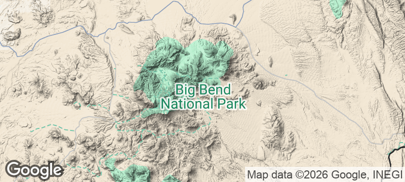
Big Bend National Park occupies 801,000 acres of the Chihuahuan Desert in far West Texas, where the Rio Grande curves sharply southward to form the international boundary with Mexico. The Chisos Mountains, rising from the desert floor within the park, create a sky island microclimate supporting species found nowhere else in the United States — including the Colima warbler, which nests only in these mountains north of the border. The nearest traffic light sits 69 miles away in Marathon. The park's interior sections achieve Bortle Class 1 darkness — the darkest measurable sky classification — making Big Bend one of the premier stargazing locations in North America. Below the park, the Rio Grande's lower canyons are accessible only by multi-day river trip and receive fewer than 200 visitors annually, ranking among the most remote navigable waterways in the lower 48.
Solo
Big Bend's immensity swallows you. Backpacking the Outer Mountain Loop, soaking in the hot springs at the river's edge, watching the stars from a desert campsite with Mexico on the far bank — this is isolation measured in geological time.
Friends
Paddle Santa Elena Canyon together, hike the South Rim for a 20-mile view into Mexico, then end the day at the Starlight Theatre in Terlingua with prickly pear margaritas. Big Bend rewards the group willing to drive far enough to reach it.
- Santa Elena Canyon's walls were carved so precisely by the Rio Grande that the cut is still measurably widening — the Mexican cliff and the American cliff are moving apart.
- The Chisos Mountains form a sky island that creates a cooler, wetter microclimate than the surrounding Chihuahuan Desert — plant and bird species found nowhere else in the United States live here.
- The park is 801,000 acres and the nearest traffic light is 69 miles away in Marathon — the night sky here achieves Bortle Class 1 in the deepest interior sections.
- The Rio Grande's lower canyons below the park, accessible only by multi-day river trip, receive fewer than 200 visitors annually — the river corridor is one of the most remote in the lower 48.
Huevos rancheros at a border café where Mexico is visible across the river.
Carne asada from a roadside parrilla in Study Butte.
Prickly pear margaritas at the Starlight Theatre in nearby Terlingua.

Mount Olympus
Greece
Home of the gods — clouds swirl around 2,917 metres of limestone and myth.

Jebel Saghro
Morocco
Volcanic spires and mesa canyons where Aït Atta nomads still winter with their herds.

Hoy
Scotland
A 137-metre sandstone stack stands alone in the Atlantic, defying every storm for four hundred years.

Phu Kradueng
Thailand
A lung-busting ascent to a bell-shaped plateau of pine forests and red maples.

Kodiak Island
United States
Brown bears taller than horses fishing salmon streams on an island bigger than Connecticut.

Channel Islands
United States
Five islands with no electricity, no shops, and foxes found nowhere else on Earth.

Boundary Waters
United States
A thousand lakes connected by portage trails where motors are banned and wolves still howl.

Katmai National Park
United States
Brown bears shoulder-deep in rapids, catching salmon mid-leap at the most primal scene in America.