
Kenya
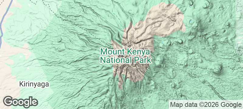
Mount Kenya
Equatorial glaciers cling to Africa's second-highest peak above a forest of giant lobelias and groundsels.
The air thins and the landscape turns alien above 4,000 metres, where giant lobelias stand like sentinels and groundsels grow into shapes that belong on another planet. Glaciers — equatorial glaciers, improbable and retreating — cling to the jagged peaks of Batian and Nelion. Below the alpine zone, bamboo forest gives way to hagenia woodland hung with moss so thick it muffles sound, and every stream runs ice-cold even at the equator.
Mount Kenya is Africa's second-highest mountain at 5,199 metres, a stratovolcano whose eroded peaks rise from the Central Highlands of Kenya. The mountain supports distinct ecological zones from lowland forest through bamboo, hagenia, and giant heather to the afro-alpine moorland where giant lobelias and groundsels evolved in isolation. Point Lenana (4,985 metres) is the trekking summit, reachable without technical equipment via the Sirimon, Chogoria, or Naro Moru routes over three to five days. Batian and Nelion require rock climbing and are among East Africa's most technical summits. The mountain's glaciers, while rapidly shrinking, remain among the last equatorial glaciers on Earth. Mount Kenya National Park is a UNESCO World Heritage Site.
Solo
The multi-day trek to Point Lenana is a rite of passage for solo adventurers in East Africa. Mandatory guides keep you safe through the altitude zones, but the walking is solitary — just your breath, your boots, and the mountain.
Friends
The Chogoria route's gorges and tarns are best shared. Friends can split guide and porter costs, push each other through the altitude headaches, and celebrate on Point Lenana with a sunrise that makes everything worth it.
- Mount Kenya is Africa's second-highest peak at 5,199 metres (Point Batian) and sits directly on the equator — equatorial glaciers on the summit represent one of the geological contradictions of the continent.
- The Afro-alpine zone above 3,000 metres hosts giant lobelias and groundsels — otherworldly plants reaching 6 metres tall, found only on East Africa's highest peaks.
- Twelve established routes to the summit range from the non-technical Sirimon circuit (3 days) to the technical Grade IV Diamond Couloir — the mountain has more route variety than any other peak in East Africa.
- Mountain huts maintained by the Mountain Club of Kenya since 1949 make multi-day ascents self-sufficient — no camping equipment needed for the main trekking routes.
Mountain hut meals of hot soup, chapati, and sweet Kenyan tea at altitude camps.
Fresh trout from the cold highland streams, grilled over charcoal at the Naro Moru gate.

New River Gorge
United States
A bridge spanning cloud level above a gorge carved by one of Earth's oldest rivers.

Canyon Guartelá
Brazil
Ancient Devonian rock carved into a canyon deep enough to swallow clouds above the Iapó River.

Copper Canyon
Mexico
Six canyons deeper than the Grand Canyon, linked by a railway that hangs over the void.

Kerlingarfjöll
Iceland
Steaming orange rhyolite mountains and hissing vents in a high-altitude geothermal desert.

Chalbi Desert
Kenya
Heat mirages shimmer across a salt-crusted moonscape where Gabra nomads appear from the haze like ghosts.

Central Island
Kenya
Three volcanic crater lakes in three different colours on an island ruled by Nile crocodiles.

Lewa Wildlife Conservancy
Kenya
Rhinos graze beside a marathon course where runners need armed escorts through the highland bush.

Ngare Ndare Forest
Kenya
A canopy walkway sways 10 metres above the forest floor, ending at turquoise natural pools.