
Canada
Cape Breton Highlands
The Cabot Trail corkscrews along sea cliffs where whales breach below and moose graze the ridgeline.
The Cabot Trail winds along sea cliffs so sheer the road sometimes seems to hover over the Atlantic. Below, pilot whales breach in pods close enough to hear the blow. Above, the highland plateau stretches away into a boreal forest where moose outnumber people.
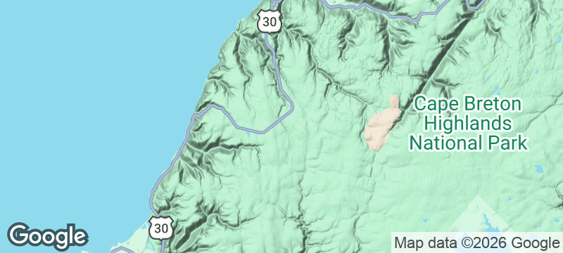
Cape Breton Highlands National Park protects the northern tip of Cape Breton Island, Nova Scotia, and the Cabot Trail — a 298-kilometre loop consistently ranked among the world's top driving routes — is the way most visitors experience it. The trail corkscrews between coastal cliffs and highland plateaus, crossing through Acadian, Scottish Gaelic, and Mi'kmaw communities along the way. The Skyline Trail at dusk is the park's signature experience: a boardwalk to a cliff-edge viewing platform where moose graze in the foreground and the sun sets over the Gulf of St Lawrence. Pilot whales and humpbacks are visible from clifftop lookouts without binoculars. The Celtic music tradition is alive in the villages along the trail — ceilidhs, fiddle sessions, and square dances happen weekly in community halls.
Couple
Driving the Cabot Trail together, stopping at clifftop lookouts, attending evening ceilidhs, and watching the sunset from Skyline Trail — Cape Breton is one of Canada's most romantic road trips.
Solo
The Cabot Trail rewards solo drivers who stop wherever curiosity strikes — a fiddle session in Chéticamp, a whale sighting from Lakies Head, a moose encounter at Skyline at dusk.
Friends
A group road trip around the Cabot Trail — with hiking, whale watching, ceilidh dancing, and seafood at every stop — is a Nova Scotia rite of passage.
- The Cabot Trail is a 298-kilometre loop that corkscrews between sea cliffs and highland plateaus, ranked among the world's top driving routes.
- Moose outnumber people in the park — sightings are near-guaranteed along the Skyline Trail at dusk.
- Pilot whales and humpbacks breach below the cliff-top lookouts, close enough to hear the blow.
- Acadian, Scottish Gaelic, and Mi'kmaw cultures layer along the trail — three distinct communities in one loop.
Lobster suppers in community halls along the Trail — all-you-can-eat for $30, served by volunteers.
Acadian meat pies and rappie pie at the Red Shoe Pub in Mabou.
Celtic-style oatcakes and tea at a cèilidh house where the fiddle music hasn't stopped since Scotland.

Kamikochi
Japan
Turquoise river slicing through an alpine cathedral closed to cars year-round.

Malham Cove
England
A curved limestone cliff face worn into alien pavement by three hundred million years.

Mam Tor
England
The Shivering Mountain — a ridge that crumbles in slow motion above a broken road.

Borrowdale
England
England's wettest valley where waterfalls thread through oak canopy into black pools.

Wells Gray Provincial Park
Canada
A waterfall wider than Niagara hides in a volcanic park most Canadians have never heard of.

Dempster Highway
Canada
Canada's only road to the Arctic Ocean — 700 kilometres of gravel and caribou herds.

Clearwater River
Canada
A river so clear the gravel glows twenty feet down through boreal wilderness no road reaches.

Churchill River
Canada
Cree pictographs and abandoned fur-trade posts along a canoe route through trackless boreal forest.