
Chile
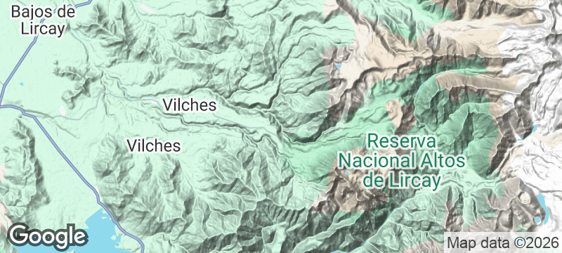
Reserva Nacional Altos de Lircay
Condors circle lenga forests that turn copper and gold, crossed by trails almost no foreigners walk.
The lenga forest ignites in autumn — copper, crimson, and gold spreading across the hillside in a single week. Above the treeline, condors ride thermal updrafts in slow circles, wingbeats unnecessary, and the basalt plateau called El Enladrillado stretches flat as a floor paved with hexagonal stone. Almost no foreign hikers walk these trails. The mountain belongs to the condors and the Chileans who come quietly.
Reserva Nacional Altos de Lircay is a mountain reserve in Chile's Maule Region, crossed by trails that see heavy local use and almost zero international traffic. The El Enladrillado plateau, reached by a four-hour ascent, is a vast volcanic flat paved with hexagonal basalt columns — the formation looks engineered but is entirely geological. Condors use the thermal updrafts above the plateau to soar without wingbeats for hours, with reliable sightings most mornings from the plateau edge. In autumn, the lenga and ñirre beech forests change colour simultaneously, the entire hillside transforming within days. The Sendero de Chile — a national trail designed to eventually run the full length of the country — passes through the reserve.
Solo
Trails almost no foreigners walk, condors circling overhead, and a basalt plateau that looks like it was laid by hand. Altos de Lircay is the kind of hike solo travellers seek when they want the mountain to themselves.
Friends
The four-hour climb to El Enladrillado earns one of Chile's most surreal geological rewards — a volcanic plateau of hexagonal stone with condors overhead. Camp in the reserve, share asado and Maule Valley wine at the trailhead in Vilches, and tell people you hiked a trail they've never heard of.
- In autumn the lenga and ñirre beech forests turn copper, crimson, and gold simultaneously — the entire hillside changes colour within a single week.
- The El Enladrillado plateau, reached by a 4-hour ascent, is a vast volcanic flat paved with hexagonal basalt blocks — the formation looks engineered but is entirely geological.
- The Sendero de Chile passes through the reserve — a national trail designed to eventually run the entire length of the country end to end.
- Condors use the thermal updrafts above the plateau to soar without wingbeats for hours — reliable sightings from the plateau edge most mornings.
Asado at the trailhead town of Vilches — grilled meat and pebre under ancient oaks.
Maule Valley Carignan red wine — the comeback grape revived by small producers nearby.
Sopaipillas bought from village grandmothers who fry them fresh for hikers each morning.

Sfakia
Greece
Rebel gorges and fortress villages clinging to cliffs above the Libyan Sea — Crete's wildest coast.

Isole Eolie — Vulcano
Italy
Sulphur vents hiss beside a crater lake where volcanic mud cakes your skin gold.

Sani Pass
South Africa
A 4x4 track corkscrews up a cliff to Africa's highest pub, mist closing behind you.

Spiti Valley
India
A high-altitude desert of wind-sculpted spires hiding Tibetan monasteries older than the borders.

Bahía Exploradores
Chile
A road ends where a glacier meets the sea. Walk on ice that touches the Pacific.

Carretera Austral
Chile
A thousand kilometres of gravel threading glaciers, fjords, and forests with almost no one on it.

Queulat National Park
Chile
A hanging glacier drips twin waterfalls into emerald forest, its ice face cracking in the silence.

Punta de Lobos
Chile
Left-hand point breaks wrap a basalt headland where big-wave surfers ride 8-metre winter swells.