
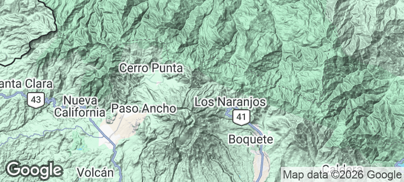
Panama
Sendero Los Quetzales
A cloud forest trail between two highland towns where resplendent quetzals flash through the mist.
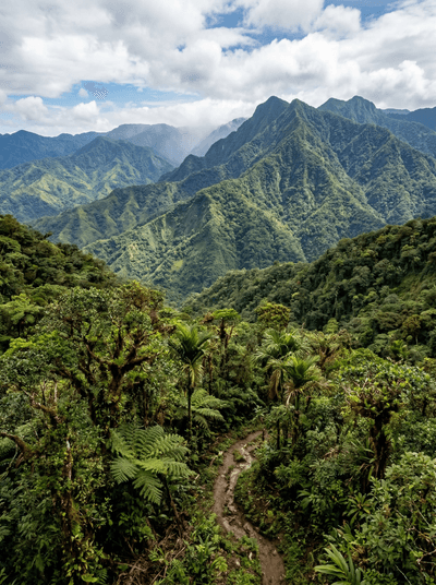
The mist hangs in the canopy like gauze, and then a flash of iridescent green cuts through it — tail streamers trailing nearly a metre behind. Sendero Los Quetzales in Panama's Chiriquí Highlands is a cloud forest trail where the resplendent quetzal, the bird the Maya and Aztec revered as divine, still nests in the mossy trunks of wild avocado trees.
The trail runs nine kilometres from Cerro Punta at 1,900 metres down to Boquete at 1,100 metres, descending through five distinct cloud forest zones as altitude and moisture shift. The resplendent quetzal nests here from February to August, and sightings with a knowledgeable guide are near-certain during breeding season. The Río Caldera runs alongside sections of the path — cold, fast highland water audible between the trees. The route is designed as a one-way walk, with luggage transferred between towns by vehicle, removing the need to retrace your steps. Boquete at the finish provides craft beer, hot food, and the satisfaction of having earned both.
Solo
Walking alone through cloud forest with quetzals overhead and the river below is the kind of day that solo hikers remember as a turning point. The trail is well-marked enough to go without a guide, though one improves your odds of spotting the bird.
Couple
The walk from one town to another through mist and forest, ending in Boquete's cafés and restaurants, has the shape of a perfect shared day — exertion, beauty, and a reward at the end.
Friends
Eight hours of forest, a river soundtrack, quetzal hunts in the mist, and craft beer at the finish. The point-to-point design means the walk builds toward something rather than looping back.
- The resplendent quetzal — an iridescent green bird revered by the Maya and Aztec — nests in this cloud forest from February to August, and sightings are near-certain with a guide.
- The trail descends 9 kilometres from Cerro Punta at 1,900 metres to Boquete at 1,100 metres, passing through five distinct cloud forest zones.
- The Río Caldera runs alongside sections of the trail — cold, fast water from the highland watershed audible between the trees.
- The route can be walked one-way with luggage transferred between towns by vehicle, removing the need to backtrack.
Hot chocolate and cheese empanadas at the Cerro Punta trailhead before the dawn start.
Highland strawberries eaten along the trail, still cool from the mountain air.
Celebratory craft beer in Boquete at the finish, earned over eight forest hours.

Jabal Aja
Saudi Arabia
Red granite peaks rising from the desert like frozen flames, hiding palm-filled valleys and rock pools.

Akchour Waterfalls
Morocco
A Rif slot canyon where turquoise river water runs between moss-covered walls.
Sonfjället National Park
Sweden
A lone mountain where the only traffic is brown bears crossing between blueberry patches.

Rakaposhi Base Camp
Pakistan
A two-hour walk from a village to stand on a glacier beneath Rakaposhi's 7,788-metre north face.

Isla Coiba
Panama
A former penal colony where eighty years of isolation let the Pacific reef thrive.

Darién Gap
Panama
The roadless gap where the Pan-American Highway ends and the jungle refuses to yield.

Cerro Hoya National Park
Panama
Cloud forest clinging to a cattle peninsula's tip, sheltering species found nowhere else on Earth.
La Amistad International Park
Panama
A binational cloud forest so dense and remote that vast sections remain unmapped.