
Kyrgyzstan
Alay Valley
A high corridor beneath a 7,134-metre wall of ice, nomad herds drifting across the plateau.
The Trans-Alay Range fills the entire southern horizon — a 7,134-metre wall of ice and rock that runs for 150 kilometres without a break. Below it, the Alay Valley opens into grassland so wide that horseback is the only sensible way to cross it. Dust plumes trail behind herds of yak and horse, and the wind carries the metallic bite of high altitude.
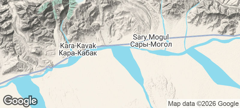
The Alay Valley is a high-altitude corridor in southern Kyrgyzstan, running east-west between the Alay Range and the Trans-Alay Range at elevations between 2,500 and 3,600 metres. The Trans-Alay's highest peak, Peak Lenin (7,134 metres), dominates the southern view — one of the most accessible 7,000-metre summits on earth, drawing mountaineers to base camps at Achik-Tash each summer. The valley itself is inhabited by Kyrgyz herders who move between seasonal pastures with their yurts, horses, and yak. The ancient Silk Road ran through here, connecting the Fergana Valley to Kashgar via the Irkeshtam Pass. Today the valley is traversed by the road to Tajikistan's Pamir Highway, making it a crossroads for overlanders, cyclists, and trekkers heading south.
Solo
The valley is a corridor to everywhere — Tajikistan, China, Peak Lenin base camp. Solo overlanders and cyclists pass through on trans-continental routes, and the scale of the landscape rewards those comfortable with their own company.
Friends
Horseback expeditions across the valley floor, base camp treks toward Peak Lenin, and wild camping beneath 7,000-metre walls. The logistics demand teamwork, and the setting repays it.
- The Trans-Alai range along the valley's southern edge has peaks above 7,000 metres — including Lenin Peak — visible at road level.
- Kyrgyz nomad families set up summer camps across the valley floor each June, some willing to take in passing trekkers for a night.
- The valley road connects south to Tajikistan's Pamir Highway — most overland travellers use Alay as the gateway in one direction.
- Permit requirements for the Tajikistan side do not apply in the Kyrgyz valley — the Trans-Alai views are freely accessible.
Yurt-camp kuurdak — organ meat stew fried crisp with onions and fat — fuel for altitude.
Fresh mare's milk kumis from herders camped beside the Trans-Alay Range.

Kolombangara
Solomon Islands
A near-perfect volcanic cone where concentric forest rings climb from reef to cloud.

Taferdouste
Morocco
A canyon carved through pink quartzite where prehistoric rock carvings line the river bank.

Ribeira da Torre
Cape Verde
A valley so narrow the sun only touches the riverbed for a few hours each day.

Falls of Glomach
Scotland
A 113-metre waterfall hidden in a gorge so remote the walk in takes half a day.

Arabel Plateau
Kyrgyzstan
Treeless tundra at 3,800 metres dotted with fifty glacial lakes and retreating ice caps.

Sary-Jaz Valley
Kyrgyzstan
A Soviet ghost town guards a valley of steppe and glacier rivers at the Chinese border.

Enilchek
Kyrgyzstan
A Soviet mining town abandoned in the mountains — apartment blocks and cinema crumbling into tundra.

Kaji-Say
Kyrgyzstan
An abandoned uranium processing site above Issyk-Kul's south shore, Cold War ruins overlooking a holiday lake.