
Kyrgyzstan
Sary-Jaz Valley
A Soviet ghost town guards a valley of steppe and glacier rivers at the Chinese border.
Rusted barracks and collapsed weather instruments mark the entrance to a valley that swallowed its Soviet occupants and kept everything else. The Sary-Jaz in eastern Kyrgyzstan is wind, glacier rivers, and steppe — the air sharp with altitude and the silence sharp with abandonment. Beyond the ghost station, the valley opens into roadless terrain where the only tracks belong to yaks and the occasional horseman delivering provisions to a summer camp.
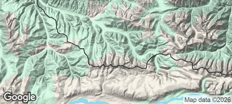
The Sary-Jaz Valley follows its river east toward the Chinese border through terrain above 3,000 metres that has no maintained road. The abandoned Soviet research station at its entrance — barracks, instruments, and storage buildings — was operational into the 1990s before being left in place. River crossings are necessary throughout the valley, making a capable 4x4 essential and sometimes insufficient. Nomad families graze the summer jailoos along the valley's upper reaches, occasionally delivering provisions by horseback to travellers who have planned ahead. Fewer than a few hundred non-mountaineering visitors reach the valley in an average year.
Solo
The Sary-Jaz strips travel to its fundamentals: route-finding, river crossings, and self-reliance. Solo travellers comfortable with genuine remoteness — where the nearest shop is a full day's drive away — will find a valley that rewards exactly that kind of commitment.
Friends
River crossings and navigation decisions are safer and more enjoyable shared. A small group with a vehicle and camp gear can spend days in the valley without seeing another party — the Soviet ruins alone justify the approach.
- The abandoned Soviet station — barracks, rusted research equipment, and weather instruments — was operational into the 1990s.
- The valley follows the Sary-Jaz River east toward the Chinese border through completely roadless terrain above 3,000 metres.
- River crossings are necessary throughout — 4x4 is essential and even that is not always sufficient.
- Fewer than a few hundred non-mountaineering visitors reach the valley in an average year.
Self-sufficient meals from a camp stove — the nearest shop is a day's drive away.
Horseback-delivered provisions from nomad families grazing the summer jailoos.

Parque Nacional Calilegua
Argentina
Cloud forest draped in moss where jaguars still prowl a jungle rising from the Chaco floor.

Cerro Hoya National Park
Panama
Cloud forest clinging to a cattle peninsula's tip, sheltering species found nowhere else on Earth.

Pohnpei Highlands
Micronesia
Waterfalls spilling from cloud forest drenched by three hundred inches of rain each year.
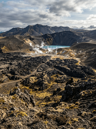
Krafla
Iceland
Boiling mud pots and steaming lava fields that still radiate heat decades after erupting.

Sary-Tash
Kyrgyzstan
A wind-battered crossroads at 3,200 metres where the road to China meets the road to Tajikistan.

Alay Valley
Kyrgyzstan
A high corridor beneath a 7,134-metre wall of ice, nomad herds drifting across the plateau.

Achik-Tash
Kyrgyzstan
Yurt camps at 3,600 metres beneath a 7,134-metre peak, alpinists and trekkers sharing vodka at sunset.

Kara-Suu
Kyrgyzstan
The Fergana Valley's largest market sprawling to the Uzbek border, languages shifting with every stall.