
Chile
Parque Nacional Alberto de Agostini
Unnamed fjords and calving glaciers in a wilderness so vast the maps show only white.
The engine cuts and the fjord swallows every sound. Glaciers hang from peaks that have no names on any chart, their blue-white faces reflected so perfectly in the black water that up and down dissolve. Parque Nacional Alberto de Agostini in Chile's Magallanes Region is the edge of the mapped world — 1.46 million hectares of ice, rock, and silence that no scheduled vessel visits.
Named for the Italian Salesian priest who spent 40 years sailing these channels and produced the first usable maps of southern Patagonia in the 1930s, Alberto de Agostini remains less cartographically documented than the surface of Mars. Thirteen named glaciers calve into fjords accessible only by private vessel from Puerto Williams. The approach requires days of navigation through channels where kelp forests brush the hull and Magellanic woodpeckers call from the shore. On windless mornings the water becomes a perfect mirror — the glacier and its reflection indistinguishable from the deck. There is no infrastructure, no trail system, no mobile signal. What exists is raw Patagonian wilderness at a scale most travellers cannot fathom.
Solo
This is solitude at its most absolute. Solo kayakers can spend days threading unnamed fjords without encountering another human, the only company glacial groans and the occasional Andean condor overhead.
Couple
For couples who define romance as shared extremity rather than comfort, an expedition vessel through these fjords offers an intimacy forged by remoteness — centolla crab dinners as icebergs drift past the porthole.
- The park covers 1.46 million hectares accessible only by private vessel from Puerto Williams — no charter services exist and no expedition vessels run scheduled visits.
- The fjord network includes 13 named glaciers, none of which appear on a complete cartographic survey — the park is literally less mapped than the surface of Mars.
- On windless days the fjord water reflects hanging glaciers so perfectly that the real ice and its mirror image are indistinguishable from the deck.
- The park was named for Alberto de Agostini, an Italian priest who spent 40 years sailing these fjords and produced the first usable maps of southern Patagonia in the 1930s.
Expedition ship meals of centolla crab and merluza as glaciers drift past the porthole.
Total self-sufficiency on land — kayakers pack freeze-dried rations for days between fjords.
Post-expedition lamb asado in Punta Arenas, the nearest real town.

Ardnamurchan Point
Scotland
The last lighthouse before the Atlantic, standing on the British mainland's most westerly inch of rock.

Janjanbureh
Gambia
A colonial island where slave traders' ruins crumble beside baobabs older than the trade itself.

Datça Peninsula
Turkey
Two seas collide at a windswept cape where almond blossoms blanket the hills each February.

Spurn Point
England
A three-mile sand spit so narrow the sea threatens to snap it in half.

Reserva Costera Valdiviana
Chile
Valdivian temperate rainforest spills directly onto empty Pacific beaches where rivers meet surf.

Laguna del Maule
Chile
Black lava flows frame a volcanic lagoon on the Argentine border, the earth still unsettled beneath.
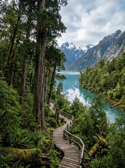
Parque Nacional Alerce Andino
Chile
Three-thousand-year-old alerce trees rise from moss-draped Valdivian rainforest — South America's answer to sequoias.
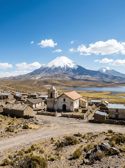
Parque Nacional Lauca (Parinacota Village)
Chile
A 17th-century Aymara church alone on the altiplano, twin volcanoes framed behind its bell tower.