
England
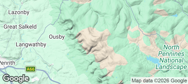
Pennine Way — Cross Fell
England's highest Pennine summit where the Helm Wind — Britain's only named wind — screams.
The Helm Wind — Britain's only named wind — funnels across the summit plateau with a force that staggers walkers and sends clouds streaming like torn flags. Cross Fell in Cumbria is the highest point on the Pennine Way and the highest summit in England outside the Lake District.
Cross Fell reaches 893 metres at its summit cairn, a broad plateau of peat and fell sandstone exposed to weather systems rolling in from the Irish Sea. The Helm Wind, a föhn-effect phenomenon unique to this section of the northern Pennines, creates a stationary bar cloud above the summit while gale-force winds blast down the western escarpment. The Pennine Way approaches from the south via Great Dun Fell and its Cold War-era radar station — an incongruous white golf ball visible for miles. The summit plateau supports montane heath and rare mosses adapted to extreme conditions. Greg's Hut, a bothy maintained by the Mountain Bothies Association, sits just below the summit and offers shelter for Pennine Way walkers caught in conditions that deteriorate without warning.
Solo
Cross Fell in weather is one of the most committing walks in England. The Helm Wind, the exposed plateau, the bothy waiting below — this is solitude that makes demands.
Friends
Tackle the Pennine Way section as a group and the shared battle against the Helm Wind becomes the story. Greg's Hut bothy turns survival into companionship — mugs of tea and wet socks around a shared table.
- The highest point on the Pennine Way at 2,930 feet — the summit plateau is subarctic tundra where the Helm Wind, England's only named wind, howls.
- The approach from Dufton crosses moorland so featureless that navigating in cloud is a genuine test of compass skills.
- Greg's Hut, a mountain bothy below the summit, offers basic shelter and the satisfaction of sleeping above England's spine.
- The ridge walk north to Dun Fell passes the radar station — a golf ball on the skyline that looks extraterrestrial in mist.
Flask tea and a slab of fruitcake on the summit — fell-walking tradition.
Lamb supper at the Shepherd's Inn in Langwathby, the nearest village with warmth.

Gaua
Vanuatu
A volcanic lake drains into the ocean via a waterfall that plunges through untouched jungle.

Quebrada de Humahuaca
Argentina
A canyon of fourteen-colour hills where Inca trails thread through villages older than the conquest.

Vale do Paúl
Cape Verde
Sugarcane terraces spill down a volcanic crater into the greenest valley in the archipelago.

Achik-Tash
Kyrgyzstan
Yurt camps at 3,600 metres beneath a 7,134-metre peak, alpinists and trekkers sharing vodka at sunset.

Malham Cove
England
A curved limestone cliff face worn into alien pavement by three hundred million years.

Whitstable
England
Pastel beach huts and oyster beds where the tide retreats to the horizon.

Rye
England
Cobblestoned lanes so steep and crooked even the houses lean in to listen.

Wistman's Wood
England
Twisted ancient oaks dripping with moss in a silence so deep it hums.