
Argentina
Quebrada de Humahuaca
A canyon of fourteen-colour hills where Inca trails thread through villages older than the conquest.
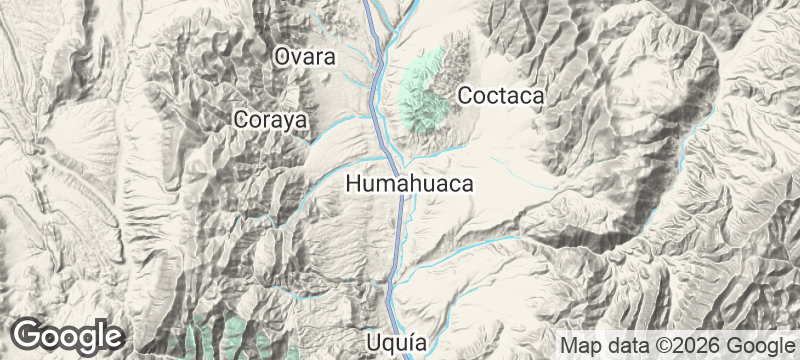
The rock strata in the Quebrada de Humahuaca change colour every hundred metres — ochre, then burgundy, then a pale green that seems impossible for stone — as if the landscape is cycling through a geological mood. This deep canyon in Jujuy Province runs 155 kilometres through the Andes foothills at altitudes between 2,000 and 3,500 metres, past adobe villages and pre-Inca ruins and markets selling textiles in colours that match the cliffs. UNESCO declared it a World Heritage Site in 2003, recognising a cultural landscape ten thousand years in the continuous making.
The Quebrada de Humahuaca was the main corridor for pre-Hispanic trade between the Andean highlands and the lower valleys, and its fourteen numbered historical towns — from Volcán in the south to Iturbe in the north — contain some of Argentina's best-preserved colonial architecture. Tilcara's Pucará fortress, occupied by successive cultures over 900 years, sits above the valley floor and offers the best single vantage point over the quebrada's full geological spectacle. The Cerro de los Siete Colores (Hill of Seven Colours) above Purmamarca has become Argentina's most photographed geological formation, though the canyon's full palette of 34 identifiable mineral colours becomes apparent only along the longer drives. The Fiesta Nacional de los Estudiantes in September fills the narrow streets with costumed processions for a full week.
Solo
The quebrada rewards the traveller moving at walking pace — ducking into village churches, buying weavings directly from artisans, watching the light change the cliff colours through a full afternoon. The depth of cultural layering here, from pre-Inca to colonial to contemporary Andean, gives the solo traveller weeks of material.
Couple
Driving north from Jujuy city with no fixed timetable, stopping when the light is right, sleeping in an adobe posada, and eating empanadas jujeñas in a village plaza is one of Argentina's most unhurried pleasures. The canyon is better discovered slowly.
Friends
The three-hour drive from Salta covers enough geological and cultural variation to sustain full days of exploration. Groups who rent a vehicle and work north through the valley, stopping at Tilcara and Purmamarca before reaching Humahuaca itself, rarely feel rushed.
Family
The coloured hills need no interpretation for children — the Cerro de los Siete Colores is vivid enough to hold any age, the market stalls in each village offer tangible engagement, and the driving distances between stops are short enough to avoid the restlessness that long Andean roads produce.
- The UNESCO-listed canyon stretches 155km and holds pre-Inca, Inca, and colonial settlements on a single road.
- Humahuaca's market trades woven textiles and dried herbs from Bolivia, Peru, and local artisans every week.
- Cerro de los Siete Colores burns most intensely at midday — the minerals change hue by the hour.
- Carnival in Tilcara brings flour-throwing and devil-mask processions that have continued uninterrupted for centuries.
Llama empanadas from a market stall in Tilcara, the meat lean and faintly gamey.
Api morado — thick, hot purple corn drink spiced with cinnamon — on a cold morning at 3,000 metres.

Meteora
Greece
Monasteries balanced on sandstone pillars 300 metres above the plain, reached by rope and faith.

Mount Vaea
Samoa
Climb through dripping jungle to a writer's tomb with the entire Pacific stretching to the horizon.

Tana Toraja
Indonesia
Cliff-face tombs guarded by wooden effigies where funerals dictate the entire rhythm of life.

Mungyeong Saejae
South Korea
Three stone gates guarding a dirt mountain pass that Joseon scholars walked to the capital.

Ischigualasto
Argentina
A moonscape where 230-million-year-old dinosaur bones scatter across wind-eroded clay mushrooms and stone cannonballs.

Buenos Aires
Argentina
Tango echoes through crumbling art-deco ballrooms where strangers dance until the city wakes.

Isla Martín García
Argentina
Four Argentine presidents were imprisoned on this river island an hour from Buenos Aires.

San Ignacio Miní
Argentina
Jungle-strangled Jesuit ruins where Guaraní once played baroque beneath a canopy now claimed by howler monkeys.