
United States
Quabbin Reservoir
Four drowned towns sleep beneath a reservoir whose silence feels almost sacred.
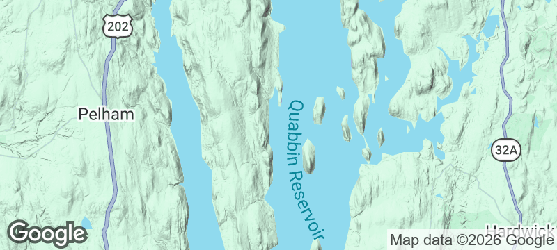
Quabbin Reservoir lies in the middle of Massachusetts like a secret the state agreed to keep. The water is still. The shore is forested and mostly fenced. Somewhere beneath the surface, the foundations of four towns — Dana, Enfield, Greenwich, and Prescott — sit in the dark, flooded in the 1930s to supply drinking water to Boston. Stand on the Enfield Lookout and the silence is so complete it feels commemorative.
Quabbin Reservoir is the largest inland body of water in Massachusetts, created between 1930 and 1939 by damming the Swift River and deliberately destroying four towns whose 2,500 residents were relocated. The cemetery headstones were moved; the buildings were demolished or burned; the valley was flooded. Today the reservoir supplies drinking water to 2.5 million people in the Boston metropolitan area, and public access is tightly restricted — no swimming, no boating, no dogs. The surrounding watershed is managed as protected forest, which has made it one of the best bald eagle habitats in the northeastern United States. Cellar holes and old road beds are still visible in the woods around the reservoir's edge, and the historical society in nearby Belchertown preserves photographs of the towns before the flood.
Solo
Quabbin is a place for people who find beauty in absence. Walk the watershed trails alone, read the historical markers, and sit with the weight of what was lost — this is solitude with a story beneath it.
- The reservoir was created by deliberately flooding four towns — Dana, Enfield, Greenwich, and Prescott — whose stone foundations and cellar holes are still visible in drought years.
- Bald eagles, rarely seen elsewhere in Massachusetts, nest in the cathedral pines along the eastern shore and are reliably spotted at dawn from the gate roads.
- Swimming, motorboats, and fishing are restricted in most sections — the enforced silence is the attraction, not an inconvenience.
- The visitor centre displays photographs of the four towns in the hours before the waters rose, with the names and last addresses of the final families to leave.
Apple cider doughnuts from orchards clinging to the reservoir's edge.
Farm-stand sandwiches with local cheese eaten on a bench overlooking the flooded valley.
Craft beer from a microbrewery in one of the surviving towns nearby.

Kanton
Kiribati
Crumbling Cold War runways where two dozen caretakers share an atoll with millions of nesting seabirds.

Fair Isle
Scotland
Britain's most remote inhabited island — knitwear patterns as intricate as the bird migrations overhead.

Giurgiulești
Moldova
Moldova's only port — a Danube sliver where a landlocked country's ships finally reach open water.

Anuta
Solomon Islands
Three hundred people share a coral speck half a mile across in the open Pacific.

Saguaro
United States
Cathedral stands of giant cacti with arms raised, each one older than the nation itself.

Joshua Tree
United States
Twisted trees and boulder piles under a night sky with more stars than dark space.

Capitol Reef
United States
Pioneer orchards still bearing fruit inside a hundred-mile wrinkle in the Earth's crust.

Lava Beds
United States
Seven hundred volcanic caves to explore alone with just a torch and your nerve.