
Argentina
Volcán Galán
A volcanic caldera so vast you stand inside without knowing the rim is thirty kilometres distant.
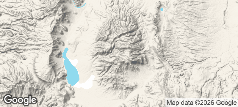
Volcán Galán in Catamarca Province is one of Earth's largest calderas — 35 kilometres in diameter, visible from satellite images as a near-perfect oval depression in the Puna de Atacama — and it is almost completely unknown outside volcanological literature. The caldera floor sits at 4,500 metres, surrounded by a 500-metre-high rim that has not been breached since the volcano's last major eruption 2.5 million years ago, and the interior contains a salt lake, fumarole fields, and thermal springs visited by perhaps a hundred people a year. The track to the rim requires a four-wheel drive vehicle and a full day to reach from the nearest town.
Galán is a resurgent caldera of the central Andes volcanic zone, formed by a series of catastrophic eruptions over the past 5 million years that deposited ignimbrite sheets across an area of 2,000 square kilometres. The most recent eruption, approximately 2.5 million years ago, is estimated to have expelled 1,000 cubic kilometres of material — making it one of the largest known eruptions in Quaternary geological history. The caldera's interior, accessible only by crossing the rim and descending 500 metres on unmarked terrain, contains Laguna Diamante at 4,700 metres, a hypersaline lake coloured pink by algae and inhabited by James's flamingos at one of their highest known nesting sites. The geothermal activity beneath the caldera floor is still measurable — the springs in the interior reach 80°C.
Solo
Galán is for the traveller who needs the destination to be genuinely unreached — not unknown in the tourist sense but structurally difficult in a way that keeps the numbers at double digits per year. The logistics of reaching the rim, crossing it, and spending time in the caldera interior require planning, a guide, and a tolerance for genuine remoteness.
- The caldera is 38km across, formed by a supervolcanic eruption 2.5 million years ago.
- Flamingos nest inside the caldera at high-altitude lagoons visible only from the rim.
- The approach requires 4WD and two full days from Antofagasta de la Sierra — no services exist.
- At 5,912m on the rim, the air holds roughly half the oxygen of sea level.
Self-catered expedition food — dried meats, bread, and mate brewed on a portable stove at altitude.
Regional empanadas catamarqueñas and locro back in Antofagasta de la Sierra after the crossing.

Gaua
Vanuatu
A volcanic lake drains into the ocean via a waterfall that plunges through untouched jungle.

Vale do Paúl
Cape Verde
Sugarcane terraces spill down a volcanic crater into the greenest valley in the archipelago.

Achik-Tash
Kyrgyzstan
Yurt camps at 3,600 metres beneath a 7,134-metre peak, alpinists and trekkers sharing vodka at sunset.

Yusufeli
Turkey
White-water rapids crash through a granite canyon where a medieval Georgian church perches on the cliff.

Quebrada de Humahuaca
Argentina
A canyon of fourteen-colour hills where Inca trails thread through villages older than the conquest.

Buenos Aires
Argentina
Tango echoes through crumbling art-deco ballrooms where strangers dance until the city wakes.

Iguazú Falls
Argentina
275 waterfalls collapse into a devil's throat of mist, thunder, and rainbow spray.

Ushuaia
Argentina
The last city before Antarctica, where beech forests dissolve into glaciers at the planet's edge.